The impact of climate change on avalanches in Slovenia
Principal Investigator at ZRC SAZU
Blaž Komac, PhD-
Original Title
Vpliv novih podnebnih razmer na snežne plazove v Sloveniji
Project Team
Manca Volk Bahun, PhD, Rok Ciglič, PhD, Asst. Prof., Mauro Hrvatin, PhD, Miha Pavšek, MA, Jure Tičar, PhD, Špela Čonč, PhD, Matija Zorn, PhD-
ARIS Project ID
J6-4627 ARRS Komac
-
Duration
1 October 2022–30 September 2025 -
Link to SICRIS
20040 -
Lead Partner
-
Financial Source
ARIS - Slovenian Research And Innovation Agency

Partners
Gozdarski inštitut Slovenije
Research Gap: To date, avalanche prevention has focused on construction measures such as barriers and galleries, but recently non-construction measures have become more frequent. Among them, data-supported governance should be highlighted. An important role in this is played by monitoring, analysis, and interaction with climate, weather, and snow conditions and avalanches, which is addressed in this project.
Contents of the project: As part of work performed so far, analysis has primarily dealt with the impact of selected geographical constants and subjective factors on avalanches, whereas this project will focus on geographical variables: it will analyze the impact of climate factors and snow cover on avalanches.
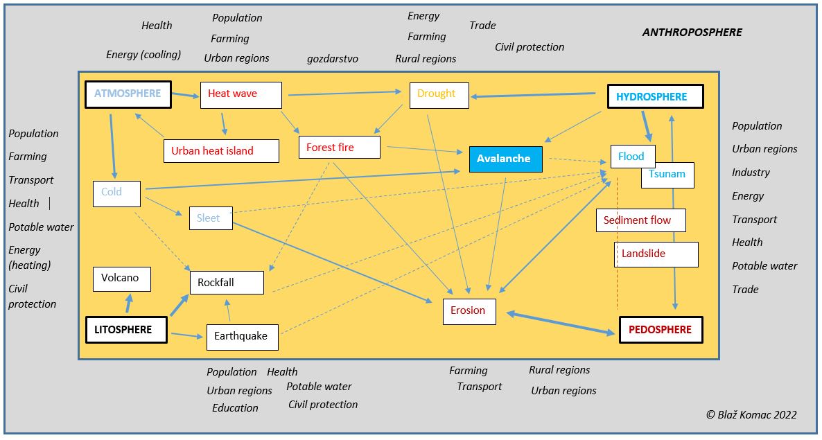
Climate factors and snow cover are sensitive to human-induced climate change, which is why extreme avalanches in particular are excellent indicators of the “new reality”, where extremes are increasing and hitherto unknown correlations are being established.
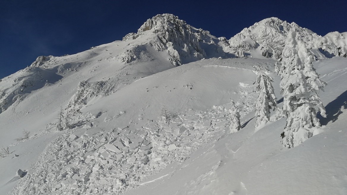
Globally, too, avalanches are the most frequent secondary natural hazard in addition to forest fires. This project treats avalanches as convergent phenomena related to climate change, which affects all natural and social systems. Avalanches are triggered at elevations around the zero-degree isotherm, and so they react rapidly to climate change, which has increased the frequency and intensity of gravitational flows in general.
In recent years, avalanches have more frequently reached the bottoms of valleys (in years 1979, 2006, 2014, and 2021). This is the result of more frequent extreme precipitation events as avalanches are caused by heavy storms characterized by heavy snow, strong winds, and variations in temperature. The trends are clear: on Mount Kredarica (Julian Alps, 2,514 m) over 100 cm of fresh snow within twenty-four hours has been recorded three times since 1952, all in the past decade. Over the past twenty years, there have been seventeen days with over 70 cm of fresh snow—three between 2000 and 2010, and eight in the past decade alone.
Such events occur in cycles, which depend on meteorological factors. There is a positive correlation between the North Atlantic Oscillation (NAO) and winter precipitation, and the same has been established for snow cover in the Slovenian Alps. The extreme situation in the early months of 2021, when avalanches reached the valley bottoms, lasted until May, which is also reflected in the ratio between the NAO and snow depth.
Expected results of the project: Based on data from recent decades, this project will study new correlations between geographical variables, such as weather factors, and avalanches. Their occurrence will be determined through monitoring at two sites and assessed according to the current weather and snow-cover characteristics measured.
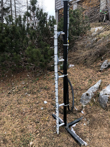
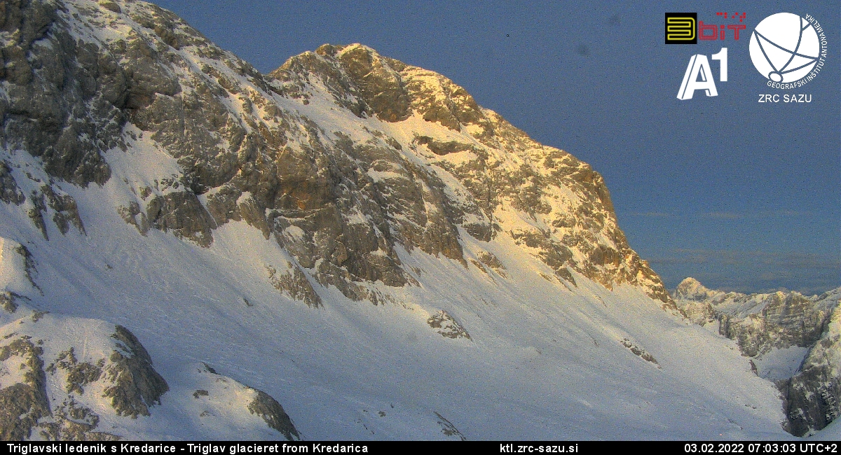
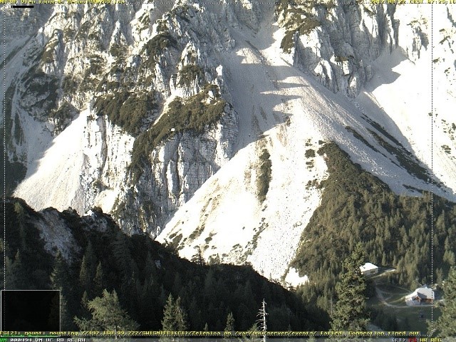
The basic climate characteristics and trends will be analyzed for Mount Kredarica (2,500 m) and the Zelenica pasture (1,500 m). Standard snow cover measurements are conducted at meteorological stations on Mount Kredarica and at the Zelenica pasture, which collect data on precipitation, fresh snow, and total snow depth. Data at the Zelenica site in the Karawanks will be complemented by surface snow temperature measurements (using an infrared thermometer) and snowpack temperature measurements. Data on climate and snowpack characteristics will ultimately be compared against data acquired from video avalanche monitoring (high) mountainous regions on Kredarica and Zelenica, where Images are captured on a Mobotix M24M camera installed at the Zgornji Plot weather station. Data on the correlation of climate and geographical variables with avalanches obtained through the measurements described will be evaluated through detailed dendrochronological analysis of trees at the Zelenica site. This site was selected due to the wooded slopes and known avalanche hazard in the area.
The study will facilitate better forecasts and timely alerts, improve spatial planning, and raise the general and specialist levels of natural disaster risk management.
During the project we will analyze the occurrence of avalanches in the Julian Alps and the Karawanks, compare it with climate and snow cover, and validate it through dendrochronological analysis. Specifically, this will be done for 1) two mountain ranges (the high mountains of the Julian Alps and the mountains of the Karawanks), 2) two elevations (1,500 m and 2,500 m), 3) the short term and the long term, and 4) weather and snow conditions. To this end, we will:
1) Monitor:
a) The meteorological conditions and snowpack measurements in the Julian Alps and the Karawanks;
b) The temperatures in the snowpack profile in the Karawanks; and
c) Avalanches using the images captured by optical cameras in the Julian Alps and the Karawanks;
2) Analyze:
a) Archival meteorological data and historical data on avalanches to assess the impact of climate change on the avalanche hazard;
b) Current meteorological data and snowpack characteristics to fill the gap in the knowledge of avalanche occurrence in relation to geographical variables;
c) Images taken by cameras to assess the frequency of avalanches and expand the avalanche register database;
3) Evaluate the results through dendrochronological analysis at the Zelenica site;
4) Use the AHP method to create an avalanche hazard model for avalanche-prone regions of Slovenia in GIS; and
5) Update the avalanche register database for both locations and display selected results in Lavinski atlas (Avalanche Atlas), which is being produced in a project currently underway, to make this material available to the public as a relevant spatial planning source.