Study of historical landscapes and their processes
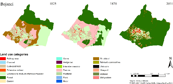
We deal with historical landscapes and the long-term processes that have shaped present-day space. We study changes in land use, shifts in borders, landscapes, and geographical names, as well as the genesis of spatial patterns. In doing so, we analyse historical cartographic and written sources that help illuminate the development of landscapes and spatial processes over time.
Projects
- Napravite mi to deželo nemško … italijansko … madžarsko … hrvaško! Vloga okupacijskih meja v raznarodovalni politiki in življenju slovenskega prebivalstva (fundamental research project • 01. maj 2017 - 30. april 2020)
- Ustvarjanje, vzdrževanje, ponovna uporaba: mejne komisije kot ključ za razumevanje sodobnih meja (target research project • 01. september 2020 - 31. avgust 2023)
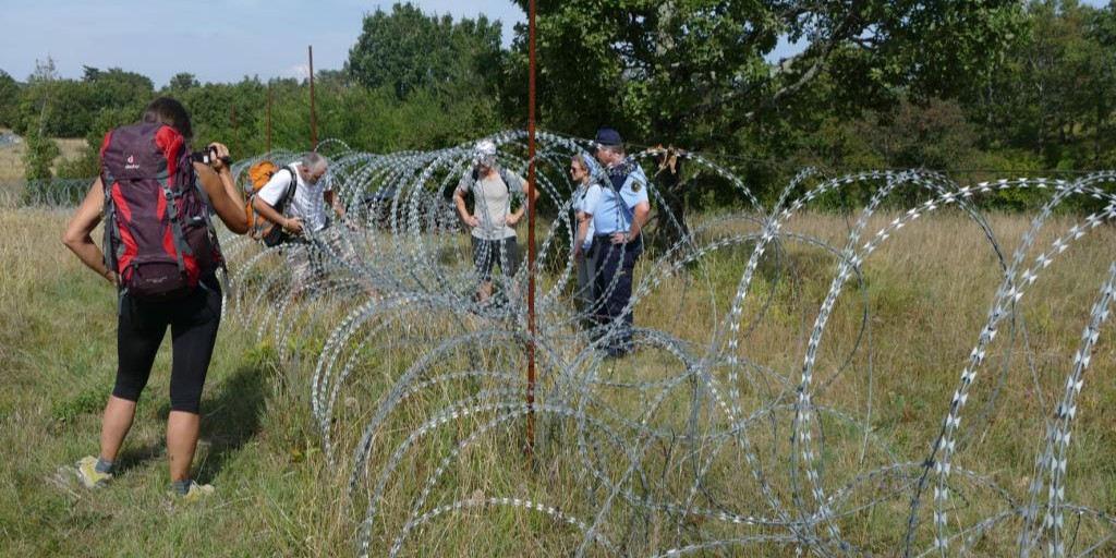
- Rapalska meja: četrt stoletja obstoja in stoletje dediščine ter spomina (fundamental research project • 01. oktober 2021 - 30. september 2024)
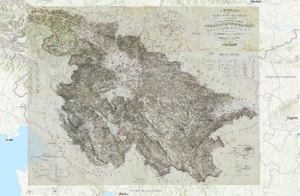
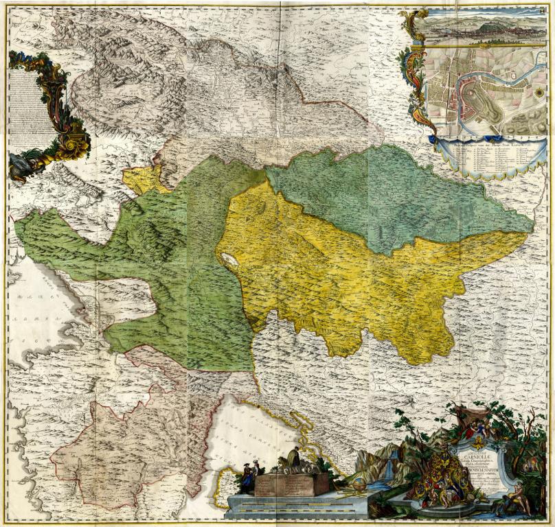
- Chorographic map of the Duchy of Carniola (national applied project • 19. januar - 20. november 2024)
- The Struggle for the Mountains: Slovene National Appropriations of the Alps, 19th-21st Centuries (fundamentalresearch project • 01. januar 2025 - 31. december 2027)
- Slovenian territory on old maps (national commercial project • 14. oktober 2025 - 01. maj 2027)
Publications
- Gašperič, P., Jerbič Perko, V., Kozina, J. 2024: Kočevsko med tnalom in nakovalom: zgodovina političnega eksperimentiranja. Kronika 72-2.
- Gašperič, P., Komac, B. 2024: Kamnik na starih zemljevidih. Kamniški zbornik 27.
- Geršič, M, Gašperič, P, Zorn, M. 2026: Geographical names and place identity in the Slovenian Alps. V: Zorn M., Pelcer-Vujačić, O,, Mikša, P. (ur.). Discourses on mountains of Montenegro and Slovenia. Cham: Springer.
- Gašperič, P., Babič, S. 2023: The semiotics of cartographic symbols on old maps. Acta geographica Slovenica 63-2.
- Gašperič, P. 2023: A new standardized methodology for analyzing cartographic information on old maps. Acta geographica Slovenica 63-2.
- Gašperič, P. 2022: Zgodovinska kartografija ozemlja Slovenije. Geografija Slovenije 37.
- Zorn, M., Ciglič, R., Gašperič, P. 2022: State borders in the territory of Slovenia during World War II on cartographic materials produced by the occupying forces. V: Repe, B. (ur.). Occupation borders in Slovenia 1941–1945.
- Geršič, M., Perko, D,, Gašperič, P. 2021: O imenu, mejah in identiteti Koroške. V: Geršič, M,, Bat, M. (ur.). Koroška : od preteklosti do perspektiv.
- Gašperič, P., Fridl, J,, Volk Bahun, M. 2020: Slovenia on maps. V: Perko, D., Ciglič, R., Zorn, M. (ur.). The geography of Slovenia : small but diverse.